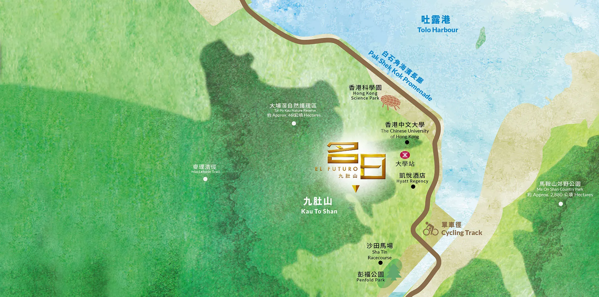
Note:
a) The facilities/buildings mentioned in the map are located near the Development and may not be located in the same district of Outline Zoning Plan of the Development, nor in the immediate vicinity of the Development. Those facilities/buildings are also not necessarily visible from the Development.
b) The community facilities, environment, facilities, infrastructure and services mentioned in the map are not the composed parts of the Development and are not related to the Development. The relevant information may not be applicable from time to time due to various factors. The Vendor does not constitute as giving any offer, representation, undertaking or warranty whether expressed or implied. The Vendor advises prospective purchaser to conduct an on-site visit for a better understanding of the development site, its surrounding environment and the public facilities nearby.
The above illustration is a simplified version and is not drawn to scale. All the information in the above illustration is for reference only and is not used to show the locations of the Development, district, routes, stations, roads and facilities. All the information in the above illustration may not be applicable from time to time due to various factors, and may be subject to the approval from the Government and the relevant authorities from time to time. The illustration does not constitute and shall not be construed as giving any offer, representation, undertaking or warranty whether expressed or implied. The Vendor advises prospective purchaser to conduct an on-site visit for a better understanding of the development site, its surrounding environment and the public facilities nearby. Source of information: Google Map (www.google.com.hk/maps), the Country Parks and Special Areas Distribution Map shown on the website of Agriculture, Fisheries and Conservation Department (www.afcd.gov.hk/tc_chi/country/cou_vis/cou_vis_cou/files/KeyPlan_1_CP_SA_v1_s.pdf), the information of Major Cycle Tracks and Parking Sites (including Shatin South, Shatin North/ Ma On Shan, Tai Po West, Tai Po East) shown on the website of Cycling Information Centre (www.td.gov.hk/mini_site/cic/tc/cyclinginfrastructure/cycle-tracks-and-parkings/shatin-ma-on-shansouth.html) and the Mobile Network Coverage along MacLehose Section 7 (cartography by Survey & Mapping Office Lands Department) shown on the website of Office of the Communications Authority (www.ofca.gov.hk/filemanager/ofca/common/consumer/mobile/country/map/OFCA-MT-S7.pdf).
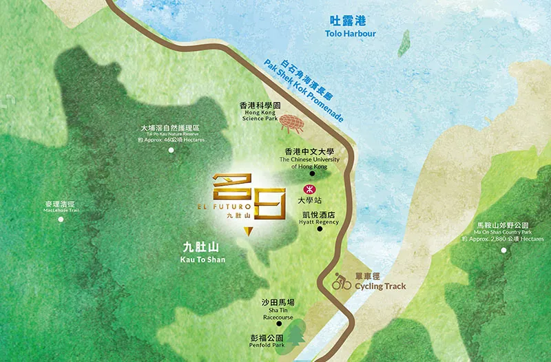